Tutkimushanke Southern Kaakinmaa and Nalkala - a DIVE analysis
TakaisinPerustiedot
-
Kunta:Tampere
Nimi:Southern Kaakinmaa and Nalkala - a DIVE analysisHankkeen tyyppi:Muu
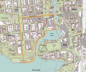
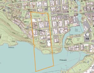
Hankkeen lyhyt kuvaus:Arkkitehtiopiskelija Andrea Perthenin laatima DIVE-analyysi Eteläisen Kaakinmaan ja Nalkalan alueesta. Harjoitus DIVE analyysin käyttämiseksi osana kaupunkisuunnittelua. Alustava, vaatii täydentämistä. Aineisto tallennettuna maakuntamuseon arkistoon.Vastuutaho/vastuuhenkilö:Pirkanmaan maakuntamuseoHankkeen loppupvm:31.12.2013
Tekstitiedot
-
Johdanto:The following is the attempt of an examplarily application of the so-called DIVE mthod to a selected
area in Tampere. It is the result of my three-month internship at KYY in summer/autumn
2012. As I have only little knowledge in Finnish and DIVE was entirely new to me, this report is far
from being complete; it should rather be a first step towards the work with that kind of approach
to the cultural environment. In the end of this paper, I will point out what is still to be done.
Due to my lacking knowledge of the Finnish language, I mainly relied on the historical photos
and maps itself, trying to get familiar with the history of the area by carefully „reading“ the pictures.
However, this led to the fact that my investigation doesn‘t reach much deeper into history
than to the end of the 19th century, when the first photos were taken. Possible ancient settlement
and the like could thus not taken into account. Here, it might be worthwhile for an archaeologist
to work on this matter.
The method
Basically, DIVE is a tool for the analysis and evaluation of historic and cultural qualities of cities.
It was developed during two international projects (SuHiTo 2003-05 and Co-Herit 2007-08) and
is still at its beginning, open for change and development.
There are four main steps in DIVE:
1. Describe: What characterises the development of the project area? This step is to be descriptive,
that is, as factual as possible. The collected information is structured particularly in „timespace-
matrices“ that allow the reader to „dive into“ the history of a place. They are mainly a „pedagogic
tool“, as one of the main developer of DIVE, Dag Arne Reinar, put it: „[They are] designed
to increase awareness and understanding of the project area‘s tangible and intangible history.“
(Reinar in: The DIVE Approach, p.8)
2. Interprete: What are the significant societal and historic narratives, contexts and elements?
From this stage on, the work should b carried out in (in the best case: cross-disciplinary) groups
to allow critical and creative discussions.
3. Valuate: What are the main qualities and values of the are? What are their development potentials
and capacities for change?
4. Enable: How can the heritage, the historical environment and the area in general be activated?
This last step is already a concrete basis for future urban plannings.
For more information, a list of links to DIVE related topics (introductions, overviews, examples)
can be found in the end of this report.